Monday, August 21, 2017

Katahdin

  • Day:  161-162
  • Start:  2184.5
  • End:  2189.8
  • Miles:  5.3
  • Hours:  7
  • High temp:  65
  • Low temp:  53
  • Thru Hikers met:  15


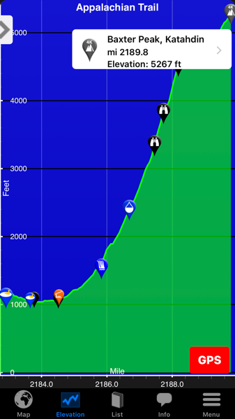
I'm starting at the little orange shelter icon, elevation 1083'
Image courtesy of Guthook

I enjoy a hearty breakfast at the Appalachian Trail Cafe then make my way back to the hostel to catch the shuttle at 0630 hrs. 
I register with the ranger getting my NOBO thru hiker summit number, #433. Then I'm on the trail to the summit at 0750 hrs.  The trail starts out smooth giving me a false sense of it's true condition. Further on up the rocks start and the water runs in the trail. But none of this matters to me, I'm traveling at a strong pace with a desire that won't be quenched until I'm on top. 


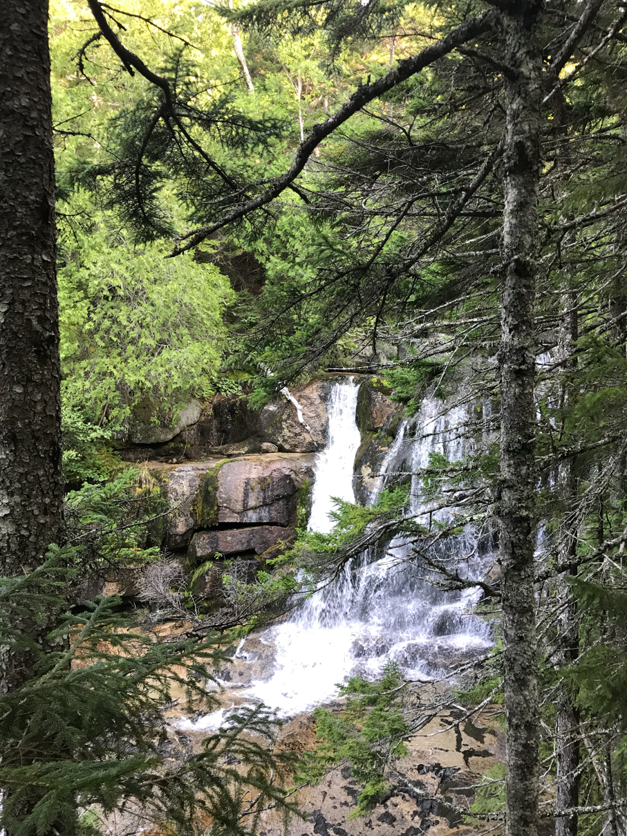
Katahdin Stream Falls


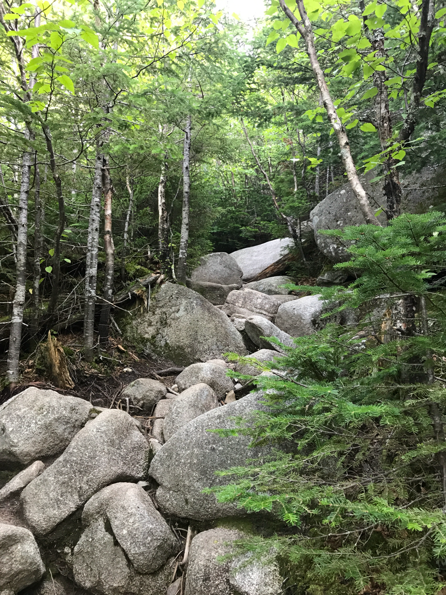
Yep it's still a rocky trail

In no time it seems I'm above the tree line realizing the rocks will just be more and somewhat bigger. Still this does not deter me from my quest, I hike on, conquering every obstacle in my path. 


Looking back at the trail I came up


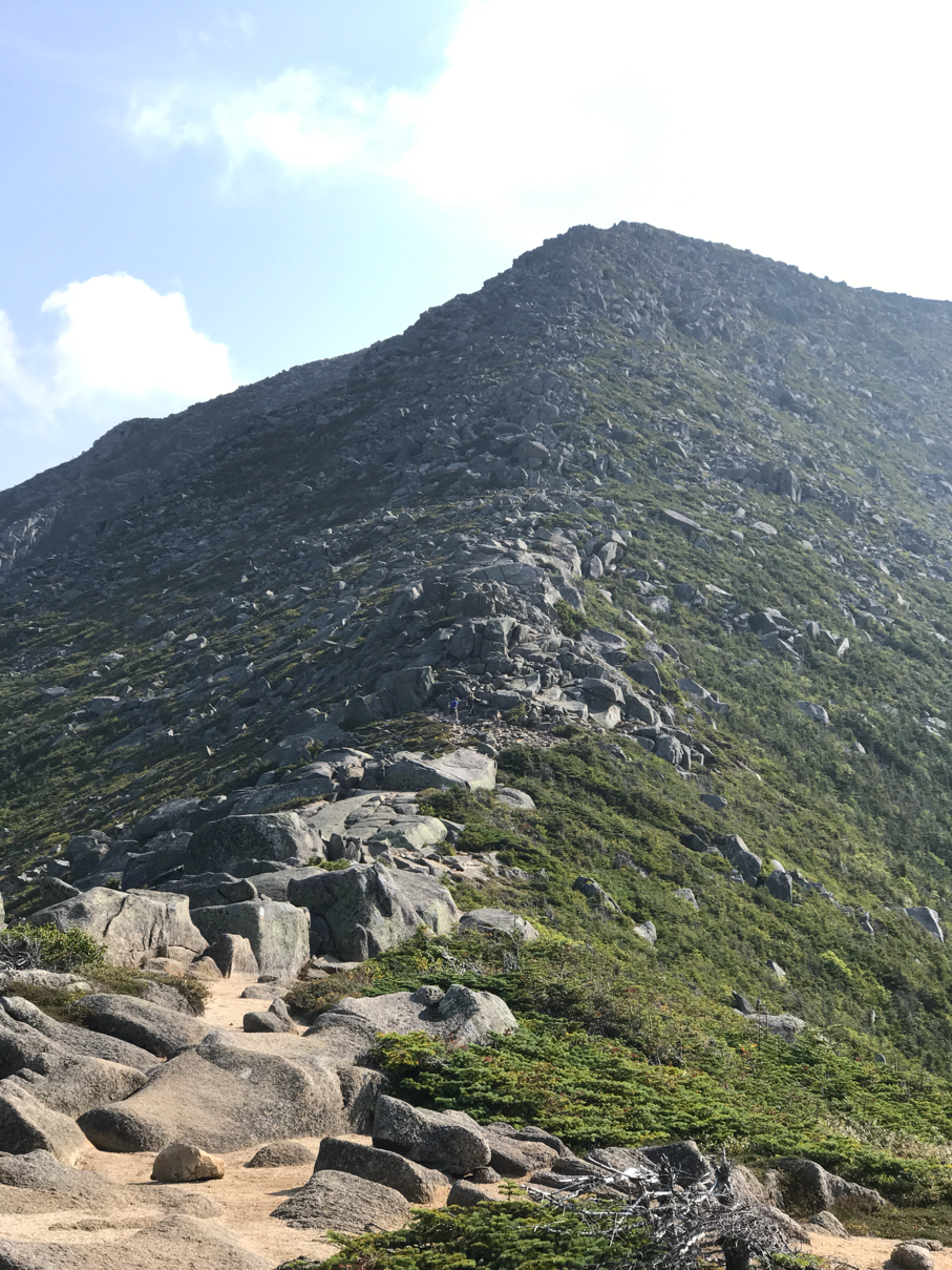
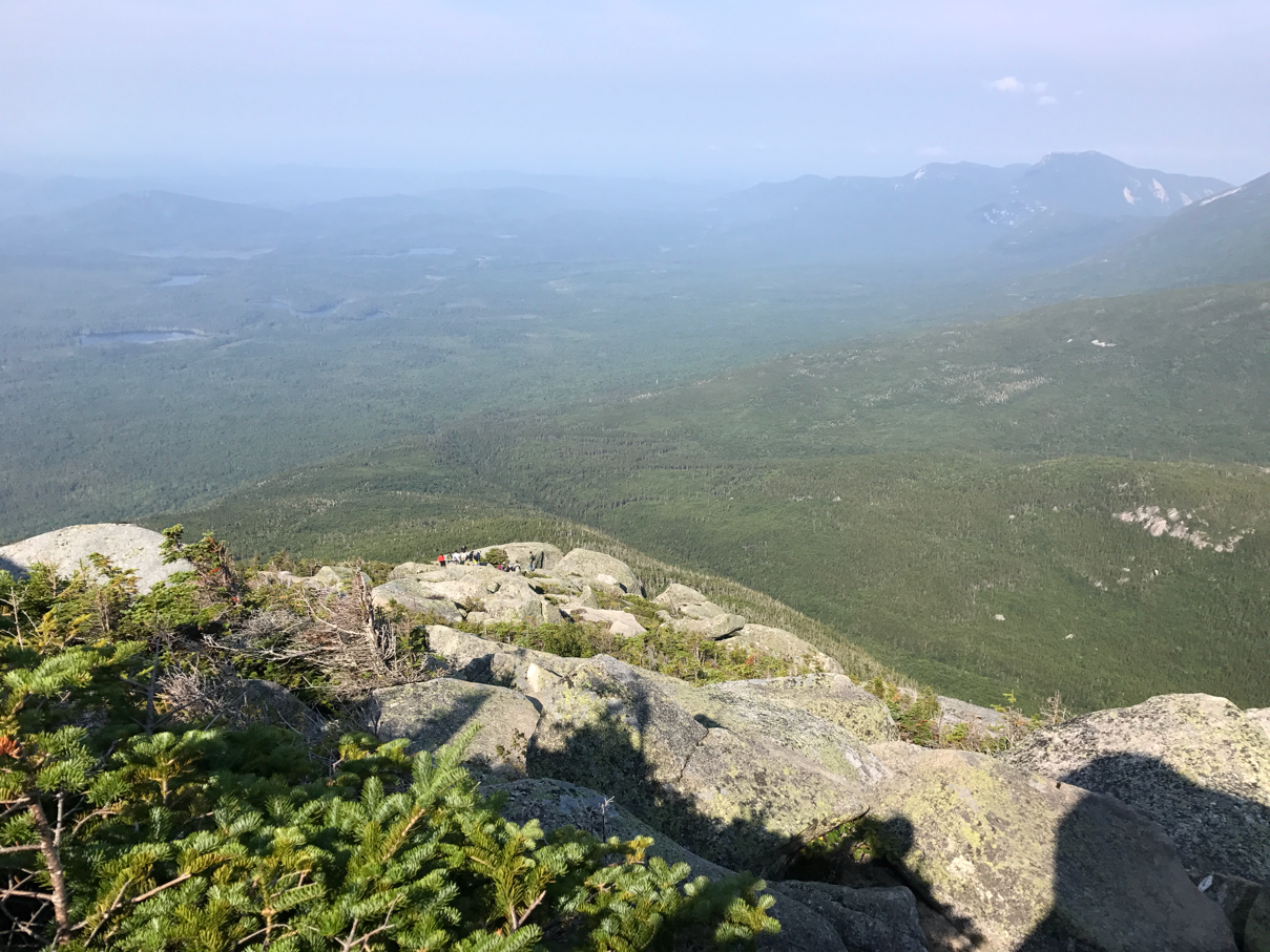
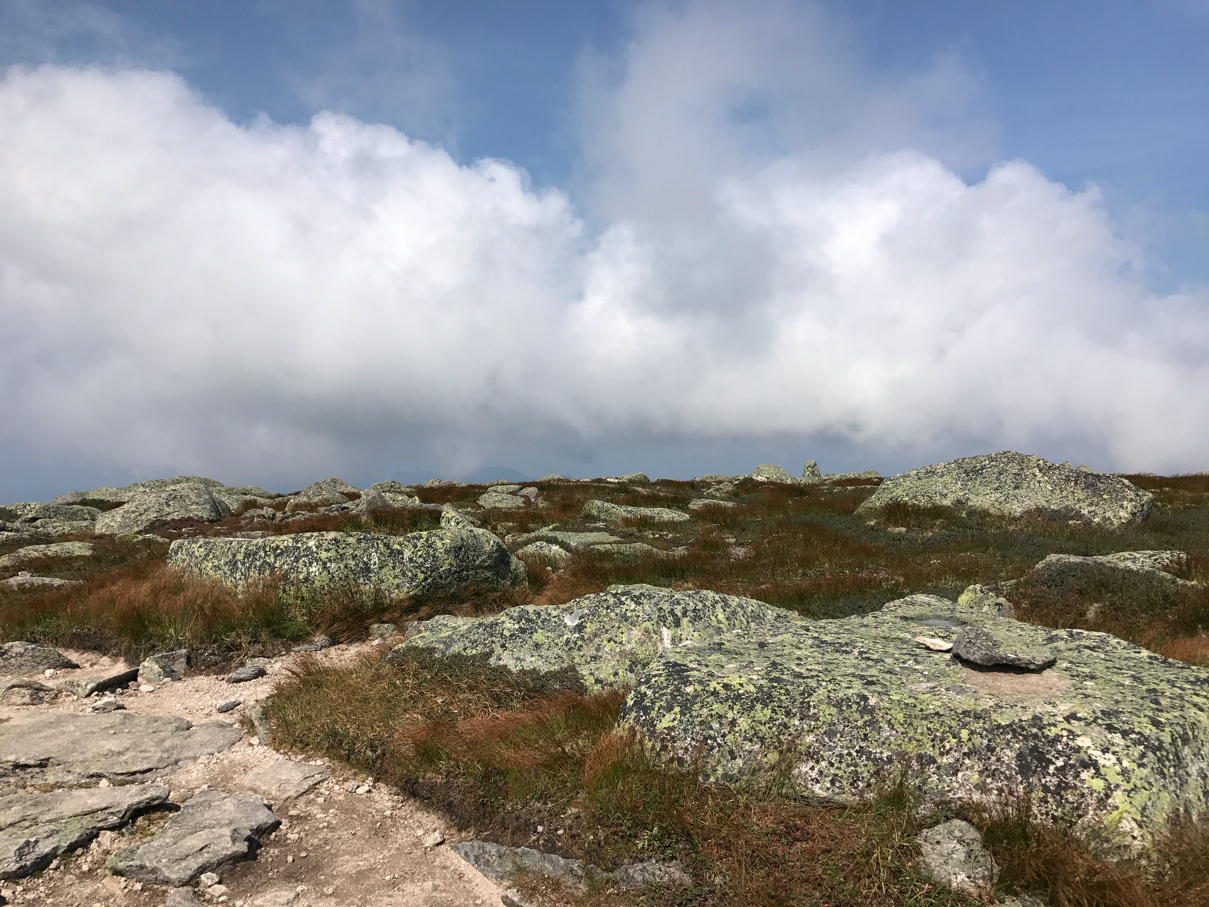
It's not the peak, over the top the terrain flattens out but continues for another mile plus

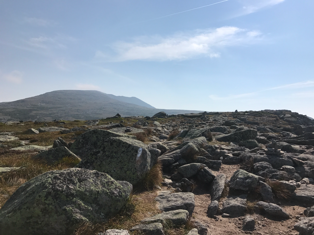
So Katahdin's Peak is the mountain you can see


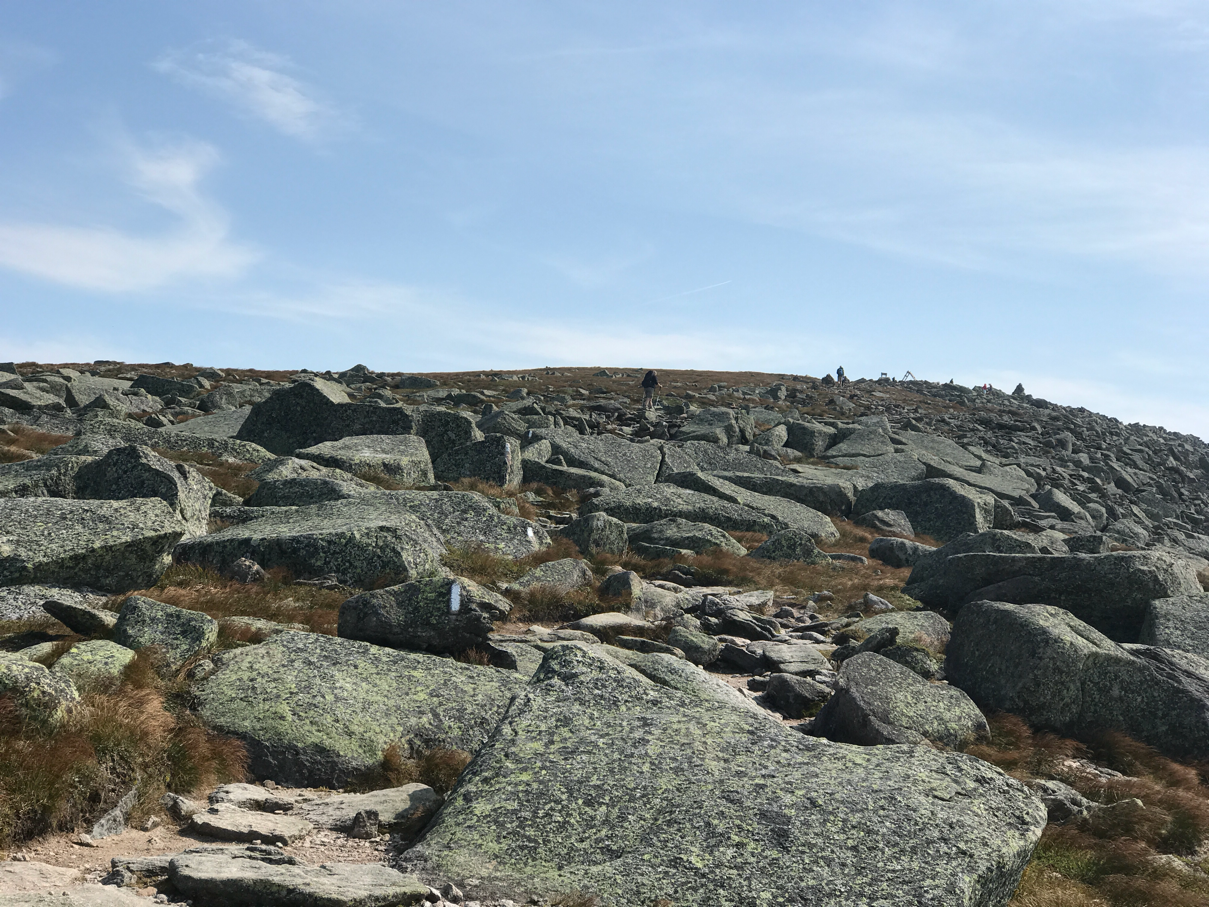
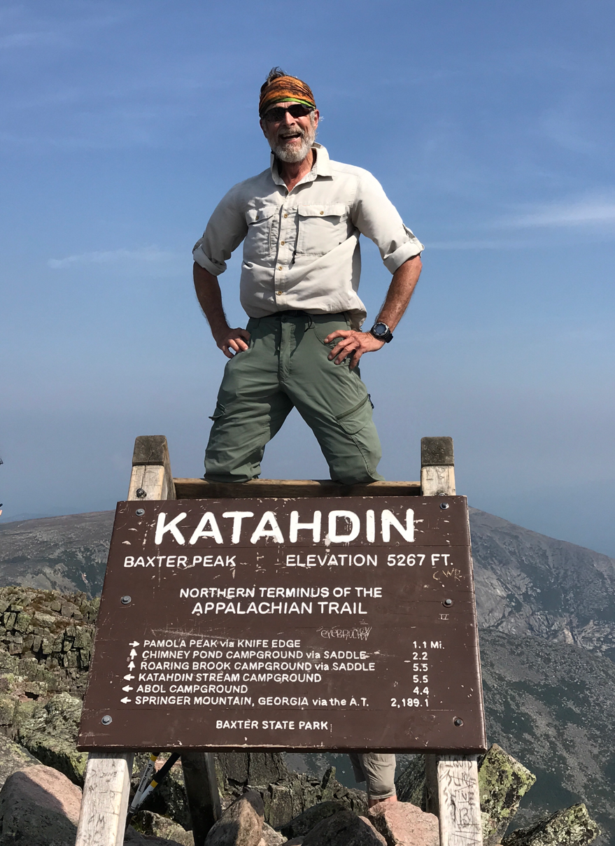
There is the summit with the sign and people

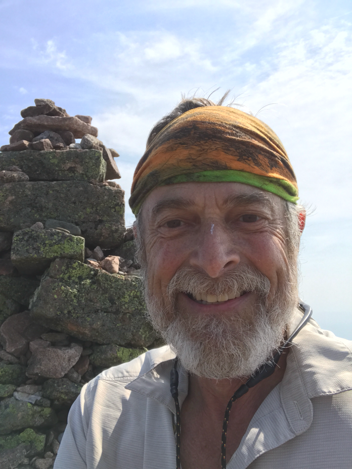
I make the summit in 2 hours, there was no stopping me.  There are about 20 others up here with me and more coming. About half of us have completed the AT, the rest are day hikers.  I am elated at this moment, asking to help others with their pictures and receiving help with mine. There is a feeling of unity as we congratulate each other on completing the AT.  The day hikers join in on congratulations adding to the elation. 


The actual highest point on Baxter Peak


And so the adventure ends on a wonderful note. 

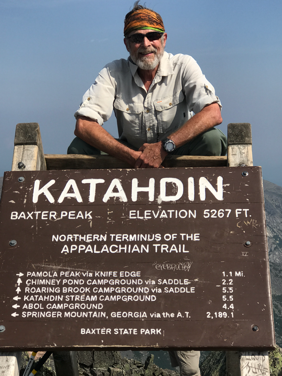
I take my pictures and then take my leave giving the summit over to those that are coming up. 


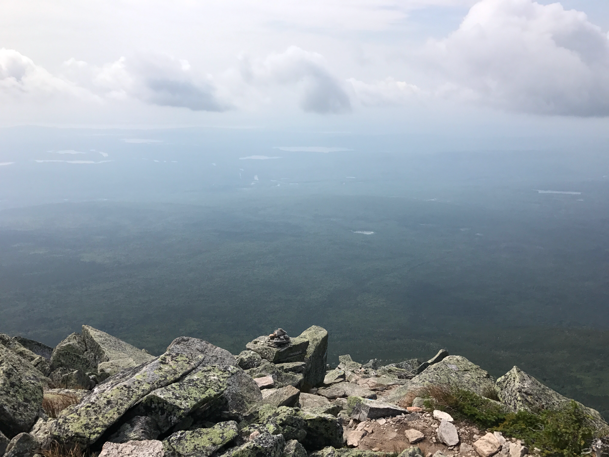
360 view from Katahdin


Clouds blow through as I descend 

I'm free to try another trail now as I've completed the AT from end to end. I choose to descend on the Abol trail, steeper but easier than the AT. 


My way down


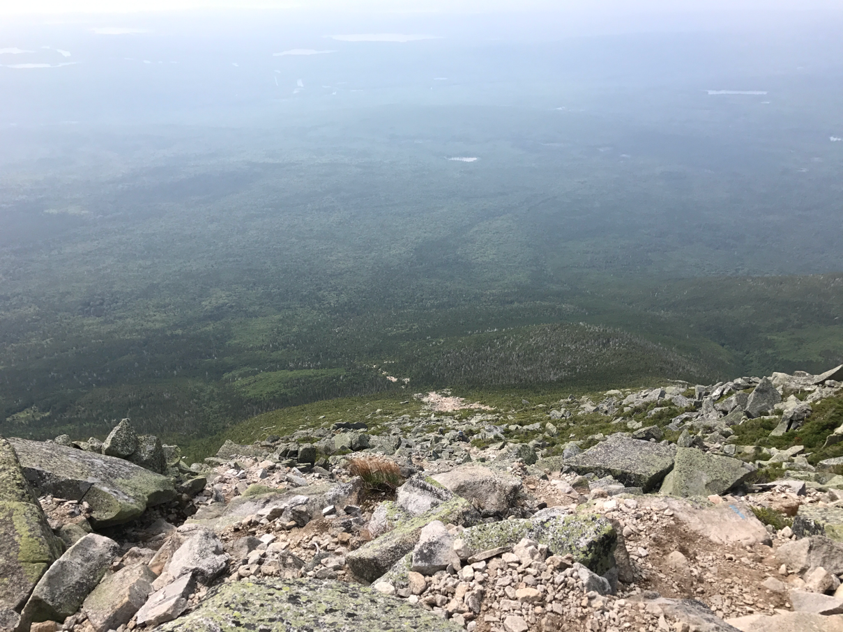
Gotta go down there where there are trees

In closing this adventure, I thank my family and friends for their positive thoughts and prayers for my safe completion of the trail.  I thank the kind people who gave me rides, fed me, and housed me when I needed shelter.  Thinking back on this adventure floods my mind with the kindness, generosity and love that I encountered. 

My final thought:  when I'm now asked " are you through hiking the AT" my answer will be "I am now". 

Sunday, August 20, 2017

Baxter State Park

  • Day:  160
  • Start:  2163.6
  • End:  2184.5
  • Miles:  20.9
  • Hours:  7
  • High temp:  65
  • Low temp:  50
  • Thru Hikers met:  1


100 Mile Wilderness 

The rain continues to fall lightly this morning, I snooze my alarm hoping the rain will stop soon. There comes a break in the rain at 0615 hrs, so I pack up getting on the trail by 0645 hrs. My goal is to do the 10 mile section ending the 100 Mile Wilderness plus the 10 mile section into Baxter State Park ending my day at the foot of Katahdin. 
As I leave I view Rainbow Lake through the trees, there is a mist hanging over the lake and the water is still restless from the storm. 


An inlet on Rainbow Lake with ducks making a run for it. 

The rain has released the balsam scent from the forest creating that uplifting atmosphere.  I dodge the mud, roots and rocks at a good clip. In just 10 miles I can get food at a restaurant by the Abol bridge., food is always a motivator.


The last bit of the 100 Mile Wilderness is very pretty this morning. I'm enjoying everything as I end this section. By 1200 hrs I arrive at the dire warning sign which is exactly the same as the one on the other end that I posted several days ago. This sign signals the end of the 100 Mile Wilderness in which I fortunately did not stumble into a fireswamp or encounter rodents of unusual size. 
I cross over the Abol bridge to a restaurant and a nice lunch. 


Restaurant for a much enjoyed lunch

Now I have a choice, get a ride to Millinocket or do the last 10 miles of the AT in Baxter State Park leaving the 5.2 mile Katahdin climb for a clear day. I discuss my chances of getting a ride from the campsite around 1600 hrs with a Baxter Ranger. He says it's doable but after 1800 hrs the chances are greatly diminished. I hike into the park finding the trail to be nicely maintained and therefore fast. 


As I cross into the park I notice the industry of local beavers 


Nicely maintained trail


The Penobscot is popular with rafters


The Penobscot River


Nesowadnehunk Stream


Nesowadnehunk Stream

I follow the trail to Daicey Pond and walk along her shores for a while. 


Daicey Pond

The sun pops through the clouds for a little while giving the forest a fresh look. My step quickens with the spirit lifting sunlight. 


I come upon Grassy Pond the last one for the day. I carefully walk some bog boards that are wet and slippery wishing to avoid a tumble. 


Grassy Pond

In short order I complete the 10 mile section in Baxter. Now I have 5.2 miles to complete the trail by climbing Katahdin. It's now 1530 hrs and I want to catch a ride to Millinocket as today and tomorrow are not forecasted good days to hike the mountain. I start walking the road out of the park, in about 10 minutes a car stops to pick me up, the drive says she is going to Millinocket. Thankfully I accept the ride. Tomorrow I'll zero and try my ascent on Monday. 

Rain Again?

  • Day:  159
  • Start:  2144.2
  • End:  2163.6
  • Miles:  19.4
  • Hours:  9
  • High temp:  64
  • Low temp:  49
  • Thru Hikers met:  2


Whites Landing, my bunk house

I had the entire bunkhouse to myself last night.  Everyone else slept in the common bunkhouse, I paid the extra $10 to get a private room of which there were 4 in my house.  A nice kitchen and living area with a table for dining.  Breakfast is at 0730 hrs, which is so late. A good spread of scrambled eggs, bacon, English muffins, juice and coffee, plus the New England staple, all the blueberry pancakes you can eat. 
I caught the first boat out and got back on the trail by 0830 hrs.  My goal is about 20 miles today so that I can reach Baxter Park tomorrow putting me with just 5.5 miles to summit Katahdin the following day. So in direct violation of my self imposed rule, "there is no need to walk into the eye of the storm", I walk. Today's forcast 70% rain, stopping in the afternoon the scattered thundershowers in the evening.  Sure enough the rain starts at 1000 hrs but stays all day. 
In short order I'm walking along the Nahmakanta Stream, a pleasantly level tread. 


Nahmakanta Stream

I follow the stream until it comes Nahmakanta Lake, a very long lake that I skirt for quite sometime. 


Nahmakanta Lake


The forest along Nahmakanta Lake 


A jumble of life


Nahmakanta Lake with Katahdin in the distance. 


Another beautiful and wet forest

I then follow Bullfrog Stream and then Rainbow Stream until I reach the Rainbow Deadwaters, these are ponds just below the Rainbow Lake Dam. The trail here is very muddy, but the all day rain is making even normally dry parts soggy now. 


Rainbow Deadwaters

I climb a bit to skirt Rainbow lake, the trail thankfully changes to a little less muddy. 


Another pretty section

As I skirt Rainbow Lake I know I'm getting close to a tenting site. When I arrive I look around to find many sites, so I select one that has tree protection and drainage. I have almost hiked the 20 I wanted so I'm ready to stop this slog and camp. 


Possibly my last tenting site for this trail

White House

  • Day:  158
  • Start:  2130.1
  • End:  2144.2
  • Miles:  14.1
  • Hours:  4
  • High temp:  70
  • Low temp:  51
  • Thru Hikers met:  0


Copper Brook

Maybe 10 hikers tenting around the shelter last night. For the most part they were pretty quiet. After a good sleep I got on the trail at 0600 hrs. Today the profile of the trail is mostly flat which makes it fast. The sky is clear with a bit of a wind in the tree tops. For a while I follow Copper Brook, I enjoy listening to it's babbling sound.  Then into the forest, conifers and moss with occasional bog boards and chair size rocks to navigate. I find it strange that the forest is so quiet. There usually are birds singing in the morning and sending out warnings in the afternoon. Squirrels will chatter out warnings as well. The only sounds I hear are the wind in the trees and the creaking of trees rubbing against one another. I have seen some chipmunks and a few small birds but that is the sum of wildlife today.  


Copper Brook heading to Copper Pond

The forest changes to deciduous trees, with the cool morning temperature and the wind in the trees it feels like Fall is coming. 


Copper Pond


Lower Jo-Mary Lake

The trail goes along the shoreline of Lower Jo-Mary Lake, touching the sandy beach. Hikers say it's great for a swim but to watch out for the leaches. I figure the only way to watch out for leaches is to pick them off your body, so I didn't swim. 
At 1100 hrs I arrive at White House Landing dock for the off the grid hostel. I text the owner and he comes out in a small boat to get me. 


Bill and his boat


White House Landing Lodge


My bunk room


Lake view and my bunk house

So here I am in the middle of the 100 mile Wilderness in a hostel., this is some trail. 

White Cap

  • Day:  156-157
  • Start:  2105.1
  • End:  2130.1
  • Miles:  25.0
  • Hours:  11
  • High temp:  70
  • Low temp:  51
  • Thru Hikers met:  8


Mt. Katahdin as viewed from White Cap Mountain 

The forcast yesterday was for rain with hail, so I stayed put and took a zero. Today is forecast is for sunny and clear skys with no rain, so I'm on the trail by 0700 hrs. Today I've got a river crossing within a mile. Given the rain last night the West Branch of the Pleasant River has not risen enough to cause any concern. 


West Branch of the Pleasant River 

The last mountain of any consequence other than Katahdin is White Cap. I start this climb and realize this will be easy because the climb is not steep.  For quite s while I hike along a delightful little stream. The water music keeps me company as I walk. 


My stream companion 

I summit White Cap Mountain and there are a couple of hikers already there. They direct me to the path for a view to the north.  When I step into the view point I realize I can see Mt  Katahdin. I now have the feelings of completion within my grasp, I'm seriously joyful at this moment. I think about my hiking friends that have already completed the trail, they must have had similar feelings when they saw Katahdin from here.  That shared experience creates a bonding between us all. 


There are several places where I spot wild blueberries, of course this means snack time. 
The forest is beautiful today, with that open feel in places and lots of moss. I come to a section that is very lumpy, rocks as big as a 55 gallon drum are covered in moss creating a soft green scene. The trail is covered deep with duff from the trees making a soft tread. 


Lumpy forest 

There are a couple of ponds on the way to my campsite.  They are the usual pleasant diversion providing a beautiful blue expanse. 


Mountian View Pond


Crawford Pond

The afternoon winds is creating waves on Crawford Pond making it look not as inviting. I check it for a possible water source and decide to seek clearer water down the trail. Within a short time I notice a clear, cold spring with a perfect place to fill my water bottles.  Now I have plenty of water for tonight and tomorrow's hike. Another 45 minutes brings me to the Copper Brook Lean-to. There are tent sites here as well, so I sellect a quiet one and setup camp. The sound of the nearby stream provides a pleasant backdrop sound to my site.  The 100 mile Wilderness is pretty and very quiet, it is a great way to finish this trail.